Saturday, 17 April 2010

Australia #3 - Franklin river expedition - day 8-10

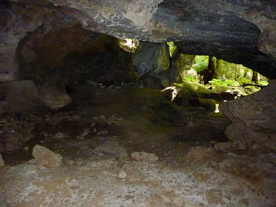
After a few days with rain and rather wet campsites, the campsite on day 7 was a very welcome change, a rock ledge under an overhanging cliff. Lots of dry space to sleep, hang out our wet gear, walk around and eat. The river kept rising and the guides suggested that we take a rest day here on day 8. Normally it would take a good 2 days of mostly paddling to get from here to the jetty, but as the river was so high they thought it would be no problem doing it in one day. And as the river was so high, all the nice campsites along the lower Franklin would be under water and the only campsites left were likely to be infested with leeches. So day 8 was a slow day with lots of food, practising safety rope throwing, and half of the group brought the rafts down some exciting rapids. On day 9 we had the last rapids and thanks to the high water we even rafted the Big Fall, which normally needs to be portaged. After Big Fall the river calmed down and the landscape changed with some beautiful limestone cliffs. We stopped at the Kuti Kina cave, a cave well used by aboriginals during the last ice age as shown by a large number of animal bones. The Franklin river joined the Gordon river, and a couple of kilometers paddling brought us to the jetty, the end of the rafting trip. A last camp under the tarp on the beach next to the jetty, deflating the rafts, sorting and packing the gear and a food feast to try to finish all the food. Later that evening the sailing boat the Stormbreaker arrived at the jetty with a couple of tourists onboard who were all warned that we would be very smelly. Day 10 had an early start with opera music from the Stormbreaker as our wake up call. Breakfast and later lunch onboard the Stormbreaker as it was quietly motoring down the misty Gordon river and across Macquarie Harbour towards Strahan. From Strahan a long 6 hour or so bus trip along winding but scenic roads back to Hobart, where we could enjoy a good hot shower and change into clean clothes that we had stored in the friendly Astor Hotel. A great trip!

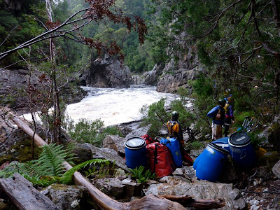
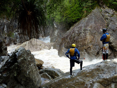
The river rose about half a meter in the 2 hours it took us to portage these rapids.

Our luxurious campsite under the overhanging cliffs.

Plenty of dry space for eating and drinking.

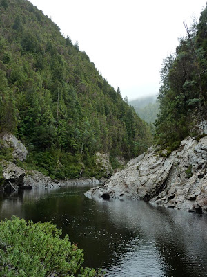
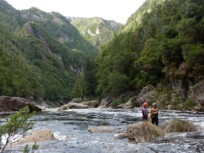
Lower Franklin river.

Kuti Kina cave.

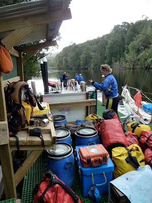
The jetty, the end of the rafting trip.


Beach camp.

The hut at lower Gordon camp, the remains of the Hydro Electricity Commission camp from when they had started the development of the Franklin river dams.

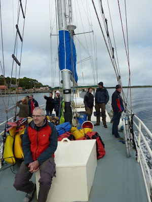
Onboard the Stormbreaker.

Strahan

Australia #2 - Franklin river expedition - day 4-7

The Franklin river, (in)famously described as 'a brown ditch, leech-ridden and unattractive to the majority of people’ by Robin Gray, the premier of Tasmania in the early 1980's, is one of the last truly wild rivers in Australia thanks to one of the largest conservation battles in Australia. In 1979, the Hydro Electric Commission (HEC), supported by the Tasmania state government, proposed to dam the Franklin river and inundate parts of the Gordon and Franklin rivers in order to increase power production and employment for the west coast area. However, economists and academics were concerned that the economic benefits were limited and conservationists, who were outraged with the potential loss of important wilderness areas and one of the last wild rivers, organised large campaigns to make the issue known to all Australians and the international public. In 1981, the Tasmanian government held a referendum where Tasmanians could indicate their choice of 2 different locations for dams, but the option for no dams was not available. The result was that 44% of the voters wrote 'no dams' across their ballot. In 1982, although the federal (Australian) government nominated the Franklin-Gordon Wild Rivers national park together with 2 neighbouring national parks for UNESCO World Heritage listing, the state (Tasmania) government withdrew parts of the Wild Rivers national park to allow construction of the dams. The Franklin River Blockade in the summer 1982-1983, both on the Franklin and Gordon rivers as well as at HEC's headquarters, started on the same day that the West Tasmania Wilderness National Parks World Heritage Area was listed and resulted in the arrest of almost 1300 people (causing an overflow of local prisons). The state government challenged new federal legislation forbidding dam construction in world heritage areas by the new federal government in 1983 and it wasn't until the High Court later in 1983 ruled that the federal legislation was valid that all dam construction was stopped.

Days 4-7 were great rafting with some good rapids, but there were also several major portages; at some we carried all baggage and the rafts over the rocks. On day 4 the rain started and it rained on and off for the next couple of days. We, and particularly the guides, were happy with the rain as it raised the water levels in the river making some obstacles easier to negotiate. However, if the water levels are too high or are rising rapidly it is not possible to raft through the Great Ravine and the night of day 5 to day 6, before the main part of the Great Ravine, one of the guides was up all night to monitor the water levels. It was perfect timing though, the water level was high but not too high; if we had been one day later we would probably have got stuck before the Ravine. On day 7, half of the group (the 4 in the other raft who were on a 7-day trip) left us and 4 new people joined us for the last 4 days. It was a cold day so we all decided to climb up to the forest road to say goodbye to the 4 guys leaving us and welcome the new people and the fresh food rather than waiting near the rafts.


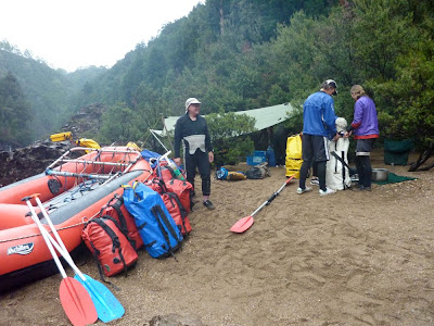
Packing up camp.

Stretches with rapids are separated by quiet pools.


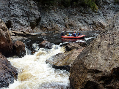
Ready to throw rescue lines. One guide and one customer take the raft down one of the wilder rapids (next photo).


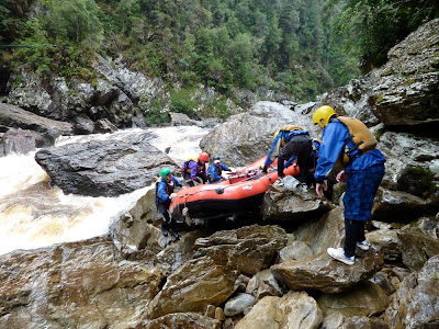
One of the rapids we had to portage (see also next photo).


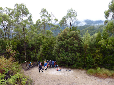
We climbed up to the end of the Mt McCall track for people exchange and fresh food delivery.

Australia #1 - Franklin river expedition - day 1-3

Finally back in Australia after more than 7 years! The first 2 weeks were in Tasmania of which 10 days a fully organised rafting expedition along the Franklin river. I have guided organised tours in the past, but have never been a participant myself, so that was a new but quite pleasant experience. It would have been nice to do this trip ourselves with the packrafts, but we just don't have any experience with proper rivers yet so that would have been foolish. But with this trip we had 2 experienced river guides, who turned out to be very good cooks as well (one of the advantages of travelling by raft is that you can take lots of food), and who guided us safely down the Franklin. The group itself was an interesting mixture of people with a range of backgrounds, but with a common interest in the environment and the history of the Franklin as well as the outdoors itself, leading to interesting discussions in the evenings.

The trip started on the Collingwood river with warm sunny weather but also very low water and the first day was more dragging and heaving the boat rather than rafting. The second day, now on the Franklin river, was a bit better, but we still got stuck on the bottom every now and then and there were some portages over log jams and tight rapids. We camped at the end of the beautiful and serene gorge Irenabyss.

My rafting outfit

Loading the rafts. The barrels and eskies are for the food.

For some of the rapids you have to either line the boat or even carry the boat and gear.

Irenabyss

Camping is under a tarp

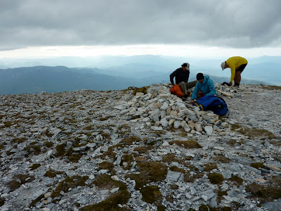
The trip description mentions that on the third day there is the opportunity to climb to the summit of Frenchman's Cap and many in the group, including us, were very keen on this. The guides did their best to discourage us (the weather forecast was for rain on day 3, none of the previous trips that season had been able to get to the summit (our trip was the last of the season), we would have to paddle long days to make up for the lost day), but we were very lucky with the weather and on day 3 we hiked with 4 other participants and one of the guides to the summit of Frenchman's Cap. First a steep climb through forest to get out of the river valley, then along the ridge with great views and the final climb to the summit. Ten years ago we walked in from the road, a 2-3 day walk, but that time we turned back just below the summit because of poor visibility, so it was great to reach the top this time.

Hiking up Frenchman's Cap on day 3


Frenchman's Cap is the white quartzite mountain to the right

The top

Top of Frenchman's Cap