Tuesday, 4 August 2009

Fairbanks #7, the Dalton Highway

We are back in Tromsø by now. The last month in Fairbanks disappeared very fast, with several trips out of town and trying to get rid of all the stuff we did not want to take with us (kitchenware, car, bikes etc.). Selling the car turned out to be very easy, second hand Subaru's in good condition are in high demand. We could not have wished for a better buyer, they let us drive the car the whole week and let us leave it in the airport carpark for them to pick up later that day. Fantastic, thanks!

We did some great trips in July, mostly road trips though, not much hiking or paddling this month. The first trip was the drive up and down the famous Dalton Highway along the Alaska pipeline up to the north coast, the only road that crosses the Brooks Range. The highway starts from the Elliot Highway 135 km north of Fairbanks, and leads 666 km across the Yukon river, the Brooks Range and the north slope to Prudhoe Bay at the north coast. Much of the Dalton is a good gravel road, but there are some sections that are full of potholes. The Dalton is the supply road for the oil fields at Prudhoe Bay and there are therefore quite a few trucks on the road which do have right-of-way. However, the scenery is amazing, particularly the Brooks Range! We took so many photos that I had trouble making a selection..... Enjoy!


Our route from Fairbanks to Deadhorse (in yellow).

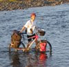
Along the Elliot Highway north of Tromsø.

Start of the Dalton Highway.

Forest fires are common in interior Alaska, mostly as result of lightning, and help rejuvenate the vegetation. The fires were particularly bad during the dry summers of 2004 and 2005 and it looks like 2009 is heading this way too, with several large fires throughout the interior. This is what it looks like 5 years after the fire, fields full of fireweed, small shrubs and birch trees.

Oversize trucks are common along the Dalton, but this one won. There are 3 trucks behind it to help push up the hills and there were 4-5 cars accompanying it to warn/stop traffic.

I guess this is not actually that special for us, although we don't often cross the Arctic circle on land.

The, (in)famous, Alaska pipeline.


Yukon river

There are 2 places along the Dalton where you can buy fuel and food, near the Yukon and in Coldfoot. This is a great little restaurant near the Yukon with good burgers and home grown vegetables.


Coldfoot. This truck delivers salt for road maintenance. The salt makes a good hard surface in dry weather, but a muddy mess in wet weather as we found out on Atigun Pass.

The hotel in Coldfoot.


Chandalar shelf. We have now left the forest behind, no trees north of here.


Atigun Pass. From here it goes down to the north coast.

Start of the north slope.


The oil fields at Prudhoe Bay. Access to the oil fields is restricted and to get to the coast you have to take a bus tour. This is one of the wells.


Wednesday, 8 July 2009

New toys: Alpacka packrafts

The Alpacka packrafts, lightweight and very tough inflatable rafts, are very popular here in Alaska. These rafts weigh about 1 kg, fit easily in a backpack and are therefore perfect for hiking/cycling/skiing + packrafting combination trips. And as there are lots of rivers here, they open up a lot of trips. And they are fun! Not cheap, but highly recommended. This was our second cycling/rafting trip, in the Chatanika valley. Normally we would wear PFD's (lifevests), but we forgot to hire them (we have them back in Norway and don't really want to buy more here) and thought that this river would be easy enough to do without. Lots of wildlife on this trip, 2 beavers, a moose, a bald eagle, 2 great horned owls, and a porcupine.

De Alpacka packrafts, lichtgewicht en erg sterke opblaasbare bootjes, zijn hier erg populair in Alaska. Deze bootjes wegen ongeveer 1 kg, passen makkelijk in een rugzak en zijn daarom perfect voor wandel/fiets/ski + boot combinatie tochten. Er zijn in Alaska heel veel rivieren in ontoegankelijke gebieden en dit opent daarom veel tochten. En het is leuk! Niet goedkoop, maar van harte aanbevolen. Dit was onze tweede fiets/boot tocht, deze keer in het Chatanika dal. Normaal dragen we lijfvesten, maar waren ze deze keer vergeten te huren (we hebben ze in Noorwegen en willen hier niet nog meer kopen) en vonden dat deze rivier makkelijk genoeg was dat het deze keer zonder kon. Veel dieren op deze tocht, 2 bevers, een eland, een Amerikaanse witkopzeearend, 2 Amerikaanse oehoes, en een stekelvarken.

It takes about 2 minutes to blow up these rafts.
In 2 minuten zijn de boten opgeblazen.

Tony.


Strange things you come across...
Je komt rare dingen tegen...

Back at the car; now we have to pick up our bikes...
Terug bij de auto; nu moeten we onze fietsen nog ophalen...

Tuesday, 30 June 2009

Prince William Sound - seakayaking

A 8-day seakayaking trip in Prince William Sound, from Whittier. Beautiful fjords, impressive (tidal) glaciers, lots of seabirds and marine mammals, rainforest, and a lot of rain. A great trip!

We are not alone here...
We zijn hier niet alleen...
Some beaches are full with dead pine trees, they don't like saltwater.
Sommige stranden staan vol met dode dennebomen, deze houden niet van zout water.

One of the developed campsites, with tent platforms, a pit toilet and bear boxes.
Een van de kampeerplaatsen, met tent platformen, een eenvoudig toilet en beer containers.

Camping in a beautiful rainforest at Decision Point.
Kamperen in een regenwoud in Decision Point.

Camping on a beach with view to a tidal glacier.
Kamperen op een strand met uitzicht op een getijdegletscher.

Campsite in Blackstone Bay.
Kamperen op een strand in Blackstone Bay.

Preparing for take off after camping in Surprise Cove.
Klaar om op pad te gaan na gekampeerd te hebben in Surprise Cove.

Nellie Juan, Culross Passage.

Back on land, on our way back from Whittier, icebergs in Portage Lake.
Terug aan wal op de terugweg van Whittier, ijsbergen in Portage Lake.


Turnagain Arm, southwest of Anchorage, has one of the biggest tidal range in the world.
Turnagain Arm, ten zuidwesten van Anchorage, heeft een van de grootste getijdeverschillen in de wereld.


Between Anchorage and Fairbanks, the Chulitna river with the Alaska Range in the background.
Tussen Anchorage en Fairbanks, de Chulitna rivier met de Alaska Range in de achtergrond.

Alaska Range.

Sunday, 14 June 2009

Fairbanks #4, around Fairbanks

American robin. They have a nest on the side of our house, with 4 young ones.

Creamer's field, where large numbers of birds stop over during spring migration. Popular with sandhill cranes and Canada geese.
 
One of our frequent visitors, the black-eyed junco.

It changed from white to green in a few weeks, view from our balcony.

'Our' house.

Spring visitor on the window.

The very popular walk to Angel rocks.

Spring is here.

Angel rocks.

Getting water at the local spring.

Fox spring.

Typical Fairbanks view, green forested hills; Chatanika valley.

One of many rivers, the Chatanika river.

Without Felix Pedro, who found the first gold in the Fairbanks area, Fairbanks may not have been here.